

National Institute of Meteorology


Weather forecast
Saturday, May 10, 2025
During these weekend days, humidity levels will be more pronounced on both sides, resulting in cloud formation and muggy conditions from early morning. Also due to this, the likelihood of scattered showers will increase this Saturday in the Caribbean and the Northern Zone, occasionally occurring in the early morning and from late morning into the afternoon. The Central Pacific, South Pacific, the western Central Valley, and the Nicoya Peninsula will experience scattered showers and rain with a possible short-lived thunderstorm.

Bulletin
Consult here the informative bulletins generated by the institution.
Climate change
One of the greatest challenges facing humanity is climate change. One issue that should concern us all. In this section you can view the climate change report or browse in our dedicated website for this importance issue.
Go website

Official emesion factors
Greenhouse gases inventory
 Weekly outlook
 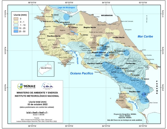 Daily rain
 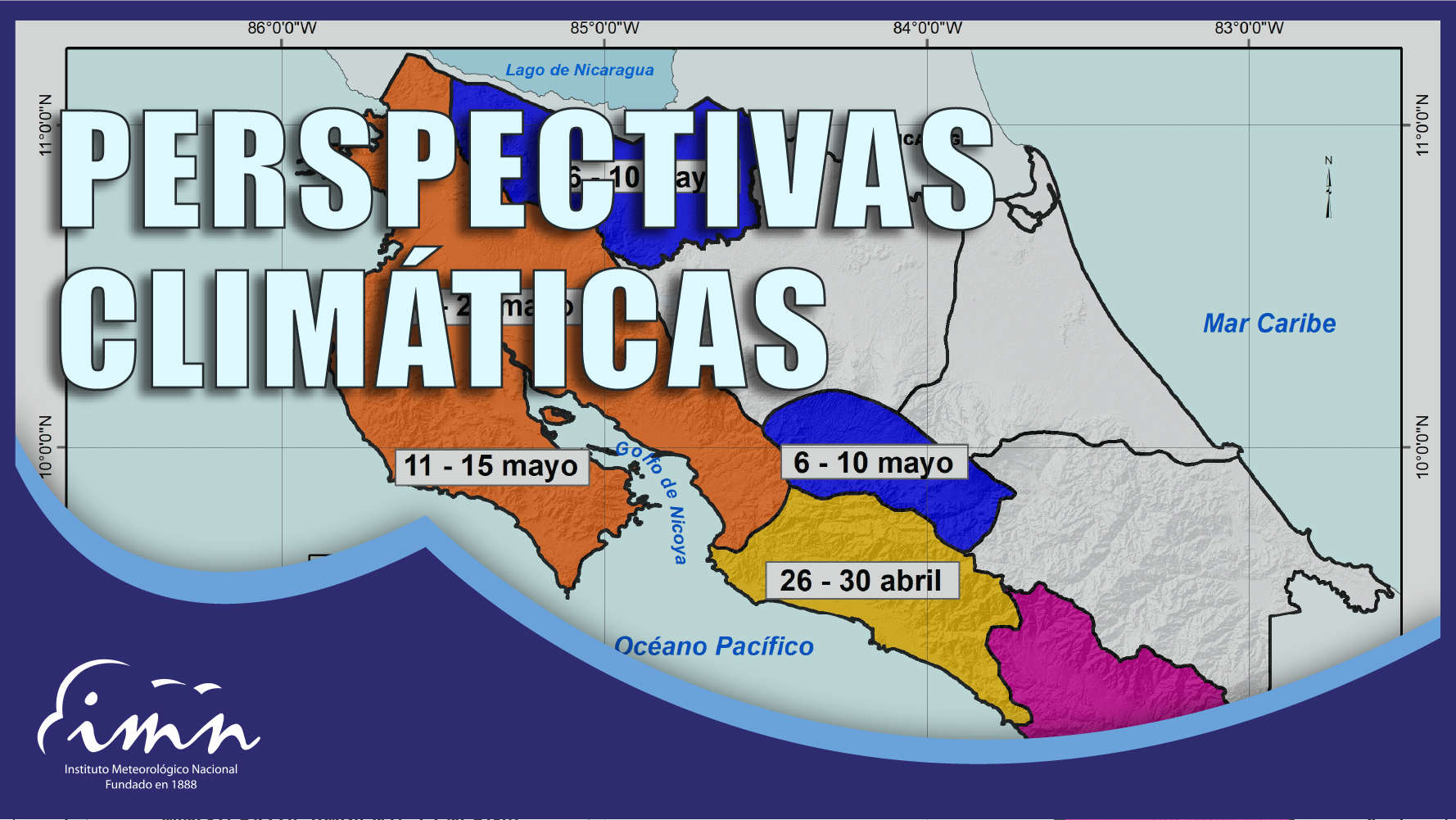 Climate forecast
 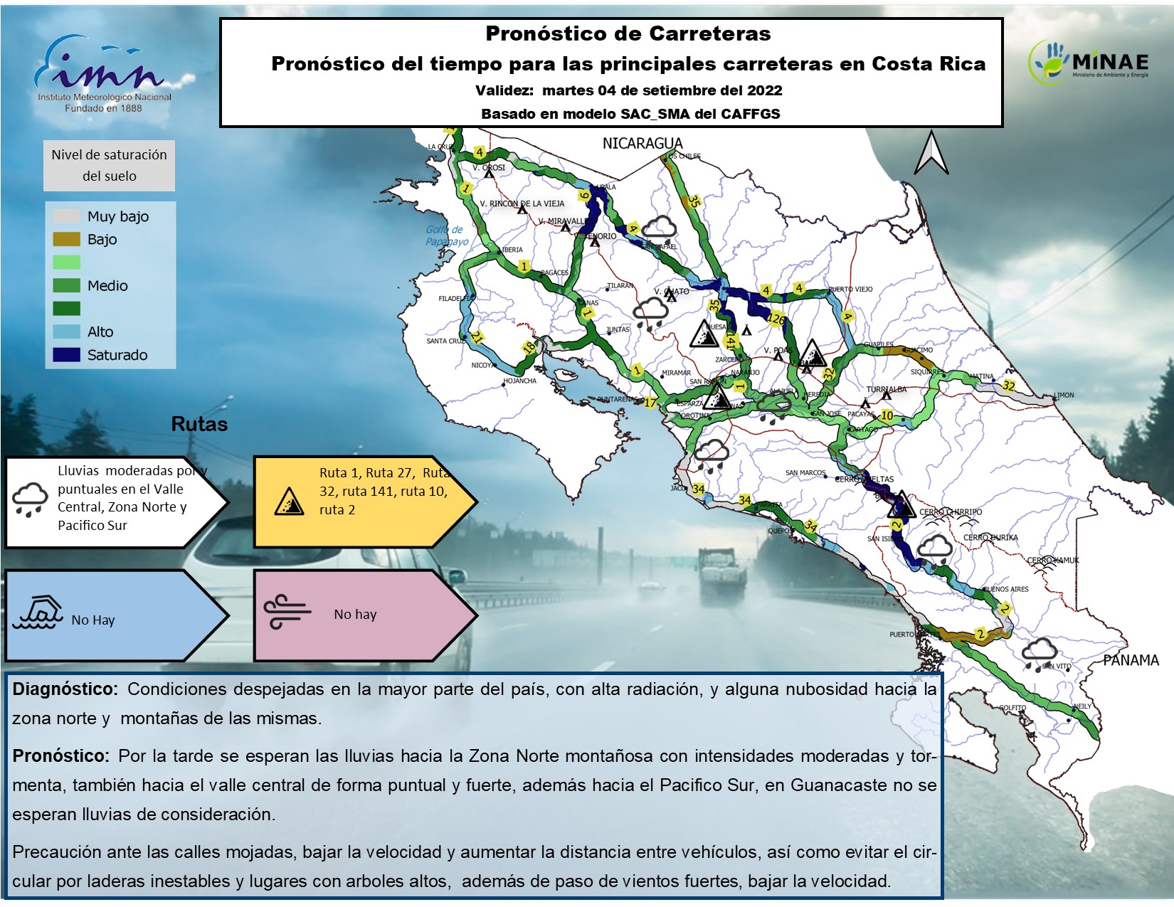 Road forecast
  Educational topics
  Climate change program